Many products are not yet listed. Please contact us for more product
information.
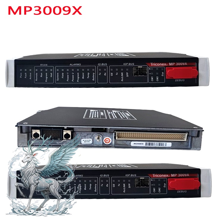
If the product model differs from the displayed image, the model number
shall prevail. Please contact us for specific product images; we will arrange to
take photos in our warehouse for confirmation.
We have 76 shared warehouses worldwide, so it may sometimes take several
hours to accurately return the information to you. We apologize for any
inconvenience. Of course, we will respond to your inquiries as soon as
possible.
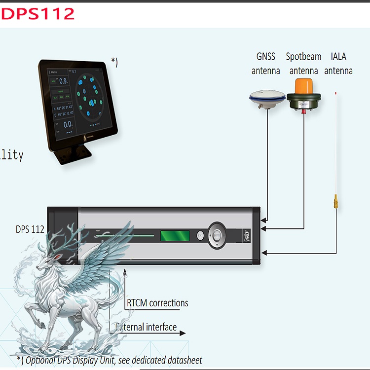
Other names for DPS112:
DGPS sensor DPS112
DPS112 DGLONASS sensor
Positioning system host DPS112
The DPS112 is a high-performance, cost-effective DGNSS (Differential Global
Navigation Satellite System) sensor from the Norwegian company KONGSBERG,
belonging to their mature DPS product series. This device is designed
specifically for marine and near-shore applications, emphasizing high
availability, reliability, and decimeter-level positioning accuracy, suitable
for ship navigation, offshore platforms, and mission-critical scenarios.
Technical Specifications and Performance
Decimeter-Level Accuracy: Achieves 10cm (95% CEP) accuracy globally via
Fugro Seastar G2 service, supporting GPS L1/L2, GLONASS L1/L2, and SBAS (such as
WAAS, EGNOS) signals.
Global Coverage: Seastar SGG service provides orbit and clock bias
correction, achieving sub-meter-level global positioning regardless of reference
station distance.
Positioning Accuracy: <0.5 meters (standard configuration), achieving
decimeter-level accuracy via Seastar G2 service, with high global consistency
and unrestricted by reference station distance.
.jpg)
Satellite Systems: Supports GPS and GLONASS dual systems, expanding
satellite coverage, improving signal availability and anti-interference
capabilities, especially performing excellently in signal-obstructed
environments (such as densely populated island areas, mountainous coastal
areas).
Interfaces and Communication: Ethernet, USB, NMEA 0183/2000, PROFIBUS,
Modbus; supports RTCM standard input; configurable external interface output;
compatible with various control systems.
Multi-interface design: 3 serial ports (2 NMEA outputs, 1 RTCM input,
supporting RS-232/RS-422 electrical isolation), Ethernet/LAN, USB (for software
updates).
Data format: Compatible with NMEA 0183 v3.0 (GGA, GLL, GSA messages, etc.)
and SNMP v2.0 alarm protocol.
Optional accessories: External display unit (supports customized graphical
interface for DP operation), IALA beacon receiver.
Environmental adaptability: Operating temperature range -15°C to +55°C
(device body), GNSS antenna withstands -40°C to +85°C, meets IP30 protection
rating, suitable for harsh marine environments.
Redundancy design: Supports dual (DP Class 2) or triple redundancy (DP
Class 3) architecture to ensure seamless switching in case of critical component
failure and maintain continuous positioning capability.
Power supply: 110-240 V AC, 50-60 Hz, compatible with marine power
systems.
Features
Calibration Service: Built-in L-band receiver, integrated Fugro Seastar
SGG/G2 service, utilizes a dual-system reference station network to calculate
"orbit and clock" calibration, providing globally consistent sub-meter/decimeter
accuracy.
User Interface: Embedded keyboard and display, optional external display
unit, supports a customized graphical interface for DP operation, intuitively
displaying position, heading, sensor data, and diagnostic information.
Maintenance and Updates: Easy software updates via USB, supports regular
sensor calibration (recommended annually) and performance checks, ensuring
long-term reliability.
Compatibility: Compatible with Kongsberg K-Pos dynamic positioning systems
(such as DP-21, DP-31), and can work in conjunction with the C-Joy joystick
control system and K-Thrust thruster control system.
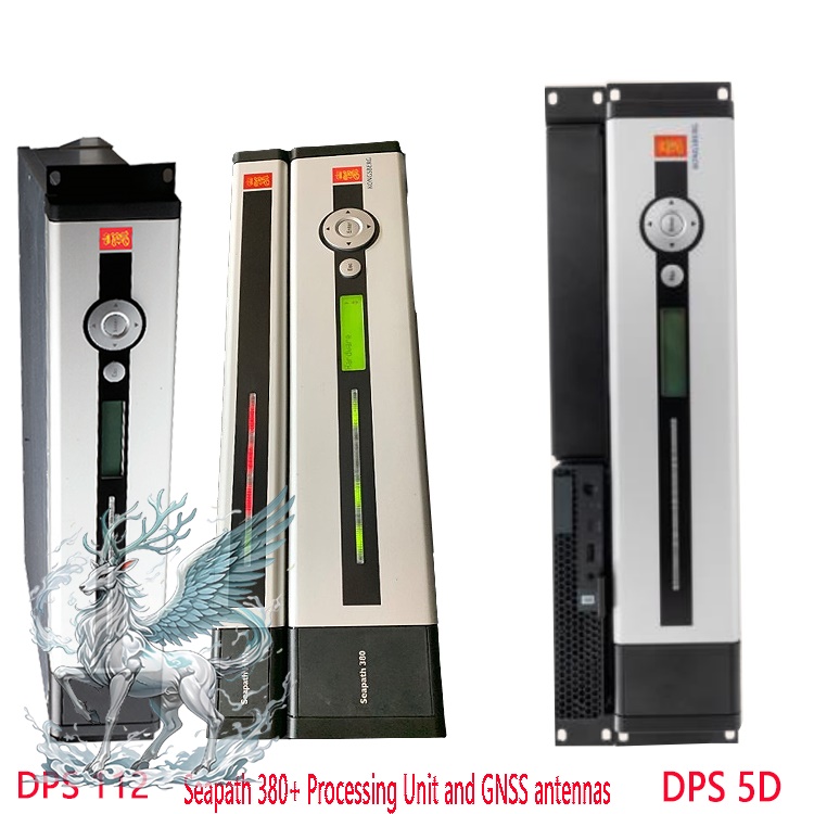
KONGSBERG DGNSS Sensor Core Models and Technical Parameters
DPS Series:
DPS112: An economical DGNSS sensor supporting GPS L1/L2, GLONASS L1/L2, and
SBAS (such as WAAS, EGNOS). Achieves decimeter-level accuracy (10cm CEP)
globally via Fugro Seastar G2 service. Features 3 serial ports, Ethernet/LAN,
and USB interfaces, compatible with NMEA 0183 v3.0 and SNMP v2.0 protocols. Main
unit dimensions: 89mm × 444mm × 357mm, weight: 5.8kg, operating temperature:
-15°C to +55°C, IP67 protection rating.
.jpg)
DPS132/232/700/4D: High-end models replacing the DPS112, integrating IMU,
expanding DP functionality, supporting higher accuracy (such as sub-millimeter
level) and multi-satellite system fusion, suitable for complex marine
environments and critical mission scenarios.
GT Series:
GT300/GT402/GT403: Supports DC 10V-15V power supply, power consumption
0.25W, static accuracy horizontal ±(2.5mm+1ppm), vertical ±(5mm+1ppm). Employs
choke coil antennas and magnetic absorbing materials to reduce multipath
effects. Supports Modbus-RTU protocol and RTCM3 differential data. Operating
environment -40°C to +85°C. Dimensions: Diameter 360mm × Height 163mm.
Application Scenarios
Ships Navigation: High-precision navigation for merchant ships, cargo
ships, fishing vessels, and yachts in complex waters (such as straits, ports,
and coastal waters) to ensure navigational safety.
Offshore Operations: Precise positioning of oil drilling platforms, FPSOs
(Floating Production Storage and Offloading) vessels, and exploration vessels;
precision operations for underwater pipeline laying, submarine cable repair, and
marine geological exploration.
Specialty Vessels: Precise maneuvering of research vessels, icebreakers,
rescue vessels, and ferries in narrow waterways or specific sea areas. Marine
Engineering: Offshore wind farm construction, tidal energy facility maintenance,
and support for wind turbine component installation and cable laying.
Special Environments: Areas with severe signal obstruction, such as densely
populated island areas and mountainous coastal regions, utilize a
multi-satellite system (GPS+GLONASS) to enhance signal coverage and
anti-interference capabilities.
Comparison and Advantages
Comparison with Traditional DGPS: Adding GLONASS expands satellite coverage
and improves system availability, especially in challenging signal environments
(such as high obstruction and multipath interference).
Superior to Regional SBAS: Seastar SGG/G2 service, based on the Fugro
dual-system network, provides globally consistent accuracy, superior to regional
SBAS services such as WAAS and EGNOS, and IALA DGPS local service.
Safety Certifications: Certified by DNV, Lloyd’s Register, ABS, and IMO DP
Class 2/3, meeting offshore operation safety standards and suitable for
mission-critical scenarios.
Installation and Maintenance
Installation Requirements: An assessment of the ship's structure and
electrical system is necessary to ensure that sensor installation locations (GPS
antenna, beacon, gyrocompass, etc.) avoid signal obstruction and interference;
power supply and communication cabling must comply with maritime safety
standards.
Maintenance Recommendations: Regularly calibrate sensors and check the
condition of antennas and connectors to ensure long-term stable system
operation; software updates are performed via USB interface, making operation
simple.
The DPS112, with its high precision, high reliability, and flexible
configuration, has become an ideal positioning solution for professional
vessels, offshore platforms, and marine engineering, especially excelling in
scenarios requiring high safety and continuous positioning capabilities.
 ABB
ABB GE
GE HONEYWELL
 TRICONEX
 KONGSBERG
 EMERSON
 FOXBORO
 MOTOROLA
 VIBRO-METER
 ICS TRIPLEX
 WOODWARD
 BENTLY NEVADA
 OTHER
OTHER

.jpg)